MODERATE
Inspiration Point
Carson-Iceberg Wilderness Edge
Stanislaus National Forest · Alpine County, CA
DISTANCE
2.5 mi OAB
ELEV. GAIN
636 ft
HIGH POINT
7,906 ft
BEST SEASON
July – Oct
PERMIT
8.5 mi RT
PARKING
8.5 mi RT
PLANNING CARD
Distance: 2.5 mi out-and-back · Chickaree TH to summit
Time: 1.5–2 hrs avg · add 30 min for lakeshore segment
Elev. Gain: 636 ft · most gain in final 0.8 mi
High Point: 7,906 ft · Inspiration Point rocky summit
Trail Type: Out-and-back · dirt, gravel, Class 2 scramble at top
Water: None on trail · carry 2L minimum
Dogs: On-leash · welcomed throughout
Cell Signal: Spotty to none · download Gaia or Caltopo offline
TRAILHEAD ACCESS
Primary TH: Chickaree Day Use Area · east end of Lake Alpine
Alt. TH: Pine Marten Campground · follow Lakeshore Trail to junction post
GPS: 38.4741, -119.9956 · Chickaree Picnic Area
Road: Hwy 4 east from Arnold · 50 mi · ~1 hr 15 min
From Bear Valley: 3 mi east on Hwy 4 · 6 min
Road Status: Hwy 4 closes east of Mt. Reba seasonally · check Caltrans
Facilities: Vault toilet + parking at Chickaree Day Use · $5/day
FIELD DEBRIEF
Food: Lake Alpine Lodge · lakeside casual restaurant + bar + general store · open Jun–Oct
Beer: Snowshoe Brewing Co. · Arnold · 50 mi west · earned après-trail pint
Coffee: Bear Valley Lodge · 3 mi west · espresso bar, opens 7 AM summers
Side Trip: Lake Alpine swimming · rock islands · lake hits 65°F+ in Aug · bring a swimsuit
Nearby: Carson-Iceberg Wilderness + PCT · Ebbetts Pass · 8 mi east
BASE CAMP
Cabin: Lake Alpine Lodge · furnished cabins + tent cabins · book 6+ weeks ahead Jul/Aug
Camp: Silver Valley or West Shore Campground · $30–31/night · recreation.gov
Town Base: Arnold · 50 mi west · full services · Calaveras wine country 20 min south
SEASON & CONDITIONS
Peak Window: July through October. Mid-July to mid-September is peak — wildflowers at seed, afternoon thunderstorms possible by 2 PM above 7,000 ft. Go early. The summit is fully exposed with no shelter from lightning. September and early October offer the cleanest conditions: cold nights, clear air, first frost turning the high meadows.
Avoid: Afternoon thunder Jun–Aug · summit by 11 AM
Winter: Gate closes Hwy 4 east of lake · snowshoe/ski access only. Road closes east of Mt. Reba around November — reopens when snowpack clears, often late May.
ECOLOGY & FIELD NOTES
Dominant Flora: Red fir (Abies magnifica) dominates the approach — dense canopy before the summit exposure. Lodgepole pine at lake edge. Jeffrey pine on drier rocky slopes. Mule ears and lupine in open breaks. Shrubby buckwheat (Eriogonum) and summit phlox grow directly from fractured granodiorite at the summit — flowering with almost no soil to anchor in.
Transition · ~7,600 ft · Mile 0.9: Red fir canopy breaks abruptly where the trail hits the granodiorite ridge — forest floor to open rockscape in under 40 feet of trail. Soil disappears. Roots stop. Rock begins. Wind doubles.
Wildlife: Black bear active — Lake Alpine is a documented feeding area near campgrounds at dusk. Store all food properly. Yellow-bellied marmot on summit rocks. Mule deer in forest margins at dawn. Golden eagle riding thermals above the ridge — the summit puts you at their flight altitude.
Bird Watch: Clark's nutcracker at treeline — the corvid that plants whitebark pine by burying caches it forgets. Every whitebark near the summit grew from a nut a nutcracker lost.
WATERSHED PATH
Summit snowmelt → Silver Creek → Lake Alpine (reservoir) → N. Fork Stanislaus R. → Stanislaus R. → San Joaquin R. → San Francisco Bay-Delta
THE GEOLOGY
Rock Type: Ebbetts Pass Granodiorite + andesitic volcanic overlay
Age: 88–94 Million Years (granodiorite) · 10–20 My (volcanic cap)
Period: Late Cretaceous batholith · Miocene–Pliocene volcanic lahars
Structure: Sierra Nevada Batholith core · glacier-carved basin at 7,303 ft
THE STOP-YOU-MID-TRAIL FACT
The lake you're looking down at was built in 1892 to move Sierra snowmelt downhill to gold mining operations in Angels Camp — 50 miles and 5,000 feet below. The Utica Mining Company dammed Silver Creek, flooded the valley, and buried the original Emigrant Road underwater. What reads as wilderness from the summit was an industrial water system. The lakeshore trail you hiked in on follows a reservoir edge, not a natural shoreline.
COMPANION TRAILS
Lake Alpine Loop Trail · 4.5 mi · flat · The flat alternative — full lake perimeter. Extends your time at elevation without the summit push. Use it the day after Inspiration Point.
Bull Run Lake Trail · 8 mi · +1,200 ft · Same trailhead zone, next technical level. Deeper into Carson-Iceberg Wilderness, above treeline. Full-day extension of this system.
PCT · Ebbetts Pass Segment · 3+ mi · 8 mi east · Volcanic geology contrasts sharply with Inspiration Point's granodiorite — two rock systems in one day. Access from Ebbetts Pass on Hwy 4.
THE REFACTOR INSIGHT
<p>The lake at the bottom of this view was built to move water downhill to a gold mine. The trail that took you here follows the reservoir's edge. You came for wilderness and stood on top of infrastructure.</p>
EPISODE NOTES
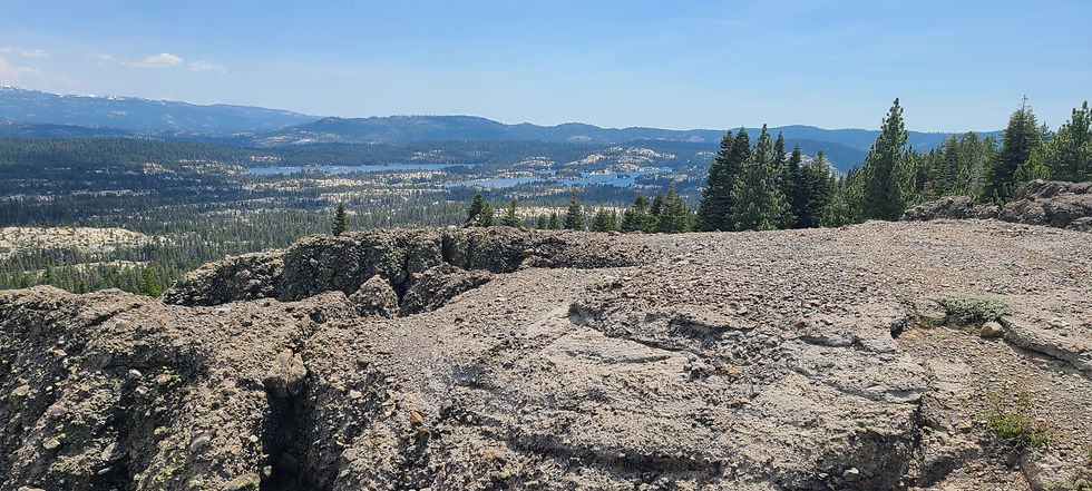
Inspiration Point is the stone butte visible from almost every point around Lake Alpine — the tall rocky formation on the south side. The view from the top is the reverse of every shot taken from the lake. You're looking down at the place you were looking up from.
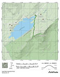
The trail gains 636 feet over 1.25 miles — most of it in the final 0.8 miles after leaving the Lakeshore Trail. Red fir canopy until the granodiorite ridge at ~7,600 ft, then bare rock, immediate wind, and views in every direction: Lake Alpine north, Spicer Reservoir Valley southwest, Mount Reba northwest, Bull Run Peak east. On a clear day, the Pacific Crest ridge beyond Ebbetts Pass is visible to the east.
From the summit, four of the Sierra's best sit in a single frame: Duck Lake, Lake Alpine, Utica and Union Reservoir — all visible simultaneously. Each one a separate watershed story. Each one reachable from different trailheads in the same system. The summit is the map.
WATERSHED INTELLIGENCE
Lake Alpine is a reservoir. Utica and Union Reservoirs — both visible from the summit — are also part of a connected system of engineered high-Sierra water storage. The Utica Mining Company built Alpine Dam in 1892. Today these reservoirs supply agricultural and municipal water far downhill. Silver Creek drains the North Fork Stanislaus River, which carries the water 196 square miles through Calaveras County into the San Joaquin River and the Bay-Delta.
NAVIGATION NOTES
Map: Download Gaia GPS or Caltopo offline — signal dead past Arnold
GPS — TH: 38.4741, -119.9956 · Chickaree Picnic Area
Road: Hwy 4 east 50 mi from Arnold · no services after Bear Valley
Fuel: Last fuel: Bear Valley Village · 3 mi west of lake
Cell: Dead from Arnold onward in most spots · do not rely on it
Note: Hwy 4 east of Mt. Reba closes each winter — typically November through late May. Check Caltrans Quickmap before departure.
TRAIL CONDITIONS BY MONTH
Jan–May: AVOID · Road closed east of Mt. Reba. Snowshoe/ski access only.
Jun: OK · Road opens when snowpack clears. Trails muddy. Wildflowers starting. Confirm before going.
Jul: PEAK · Peak wildflower. Afternoon thunderstorms — summit by 11 AM. Gets busy weekends.
Aug: PEAK · Best conditions. Lake warm for swimming. Go early — storms by 2 PM above the ridge.
Sep: PEAK · Best overall. Fewer people. Crisp mornings. First frost in high basins. Brilliant light.
Oct: OK · Window closing. Cold nights, possible snow above 7,000 ft. Road closes ~November.
Nov–Dec: AVOID · Road closed. Do not attempt without backcountry and avalanche gear.
EPISODE CREDITS
Episode: FFN-IP-004 · Inspiration Point · Lake Alpine
Location: Alpine County, CA · Stanislaus National Forest
District: Calaveras Ranger District · Stanislaus NF
Collaborator: Oliver · @XploreForge · May 24, 2026
Community: skool.com/explore-the-field-8042
Submit Trail: xploreforge.com/submit